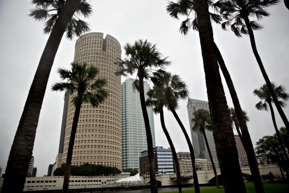
(Bloomberg) — Hurricane Ian is gaining power as it nears Cuba on a path toward Florida, threatening to become the worst storm to hit Tampa in a century.
Most Read from Bloomberg
Ian’s winds continued to strengthen, reaching 85 miles (137 kilometers) an hour as it churned in the Caribbean about 195 miles southeast of the western tip of Cuba, the US National Hurricane Center said in an advisory at 2 p.m. New York time. A hurricane watch is in effect along Florida’s west coast, including Tampa Bay. More than 300,000 people are expected to evacuate.
“Life-threatening storm surge is possible along much of the Florida west coast, with the highest risk from Fort Myers to the Tampa Bay region,” Brad Reinhart, a hurricane specialist at the center, said in his analysis. Tropical storm winds could reach Florida late Tuesday, with hurricane conditions arriving Wednesday morning. Significant river flooding is likely across central parts of the state.
Ian’s center is set to pass near the Cayman Islands Monday and then overnight near western Cuba, where the storm surge could raise water levels by as much as 14 feet (4 meters) above normal, according to the hurricane center. Rains could produce flash flooding and mudslides in parts of Cuba.
Cuban President Miguel Diaz-Canel warned the Communist nation Monday that it would be facing a “challenging week” as Ian barrels down on the western tip of the island.
“We must defend human lives and material goods,” he wrote on Twitter. “We cannot fail.”
The island is suspending train service starting at noon and some schools were being closed, state-run Cuba Debate reported. Hurricane alerts were issued for seven western provinces including the capital, Havana.
Track Ian’s latest path
Ian will likely be the first major storm to hit the continental US this year. AccuWeather Inc. expects the storm will ride up Florida’s west coast and make landfall Friday. Hurricanes spin counterclockwise in the Northern Hemisphere, so in Ian’s case its strongest side would be pointed directly at the Florida coastline.
“It is going to be a very dangerous storm,” said Paul Walker, a meteorologist with AccuWeather.
Ian’s winds are forecast to peak at 140 miles per hour late Tuesday through Wednesday, before dropping to 120 mph on Thursday, the center said. The storm will encounter wind shear in 36 to 48 hours, which will hold it back from gaining even more strength.
Still, Hurricane Ian would be the worst storm to hit Tampa in 101 years, according to Chuck Watson, a disaster modeler with Enki Research. The area has had many close calls in recent years, including Elsa last year and Irma in September 2017, but the last devastating strike on the Tampa-St. Petersburg area was a 1921 storm that would have caused $30 billion if it hit today.
Initial estimates call for a storm surge of 5 to 10 feet in Tampa Bay and along the coastline around the area.
Chevron Corp. announced that it’s shutting two oil production platforms in the Gulf of Mexico southeast of New Orleans ahead of Ian. However, on its current path, the storm is expected to miss most of the energy infrastructure in the Gulf.
Ian is the second destructive hurricane to rip across the Atlantic in less than a week, following Hurricane Fiona. Fiona struck Atlantic Canada over the weekend, causing extensive damage, power outages and flooding across Nova Scotia and Prince Edward Island. Damages to the region are estimated at $3.5 billion, though secondary factors and rain may push costs above $4.5 billion, according to Watson.
Evacuation Order
Ian is forecast to be a Category 4 hurricane off Hillsborough County, which includes Tampa, and could push a storm surge of 15 feet into the shoreline, Tim Dudley, county emergency management director, said in a YouTube post. Mandatory and voluntary evacuation orders have been issued, and the county will be opening shelters, said Bonnie Wise, the county administrator, in a briefing posted on YouTube. The county expects to evacuate more than 300,000 people, she said.
President Joe Biden approved an emergency declaration for Florida on Saturday, freeing federal disaster aid to the state. He also postponed a scheduled trip on Tuesday to the state that included a Democratic National Committee rally in Orlando. Governor Ron DeSantis declared a state of emergency across Florida and warned residents to prepare.
Forecasters are also watching a second system that has a 70% chance of becoming the Atlantic’s next storm later Monday.
(Updates strength in second paragraph.)
Most Read from Bloomberg Businessweek
©2022 Bloomberg L.P.


